

Will Low-Pressure on Bay of Bengal Intensify to Cyclone Hamoon, Check Forecast

Bhubaneswar: A low-pressure area has formed in the south-central and adjacent southeast regions of the Bay of Bengal. It is being influenced by a pre-existing cyclonic circulation in the area.
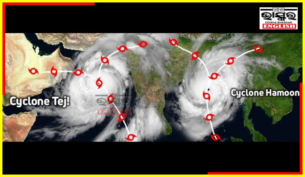
Projections hint that in the next 48 hours, this system may change into a depression, slated for October 22. It may transform to a deep depression on October 23. This system may intensify more into a mild cyclonic storm, potentially around October 24th-25th. If it happens, then it will be officially named ‘Hamoon.’
But this forecast is still in a preliminary stage.
As per weather experts, this system is set to take a north-northeastward course parallel to North Odisha and the Bengal Coast. But it will travel at a safe distance from the coastal regions.
The low-pressure area over the southeast and the adjoining southwest Arabian Sea, which has developed into a depression, is likely to intensify into a cyclonic storm by October 21, stated the India Meteorological Department (IMD) on Friday.
This cyclonic storm will be called ‘Tej’, according to a formula followed for naming cyclones in the Indian Ocean Region.
 Home
Home Videos
 Odisha
 Nation
 World
World Crime
Crime Politics
 Sports
 Health
 Lifestyle
 Business
 Education
 Entertainment
Comments are closed.